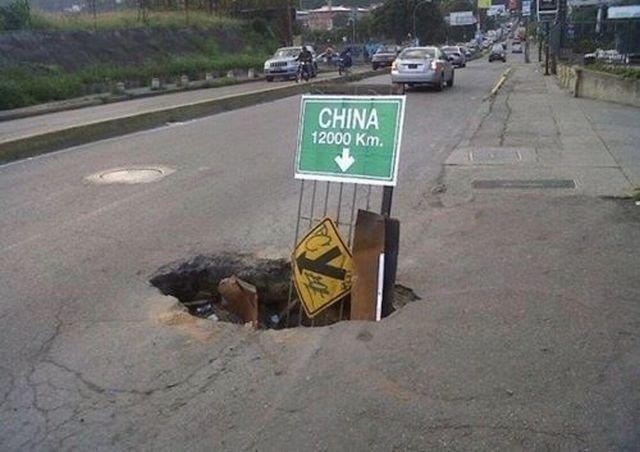
 Actually the statement that you'll eventually end up in China is only true in
South America (but see next point) and in particular Argentina: but not just
Argentina because China is approximately 3.5 larger than Argentina so there will
be antipodal points outside of Argentina that go into China; however it is the
usual example for the antipode of China and that's what I use in my included
maps and [try.sh](try.sh).
In no case, however, will you end up north of the equator if you dig (okay
obviously you wouldn't get that far but you know what I mean!) through the Earth
north of the equator and in no case will you end up in the eastern hemisphere if
you dig from the western hemisphere because the fact is the hemisphere is
flipped and so is the pole.
Below I talk about the type of map I have provided and calculations but how well
I can do that I guess we'll have to wait and see.
Anyway: yes this is a real thing. Most antipodal points end up in an ocean
(though many of those have their antipode on land). I've heard the Earth is
mostly water and most of that an ocean and I guess that's why (Landon will
inform me if I'm wrong :-), as [he's an astronomer](http://www.isthe.com/chongo/tech/astro/index.html),
and if this is true it causes a lot of problems for Flat Earth: just like magma chambers, lava
tubes [aka pyroducts and lava tunnels], volcanoes, sinkholes and many other
natural formations on and in (ah, maybe it is Hollow Earth! :-) ) our beautiful
Tetrahedral :-) Earth do.
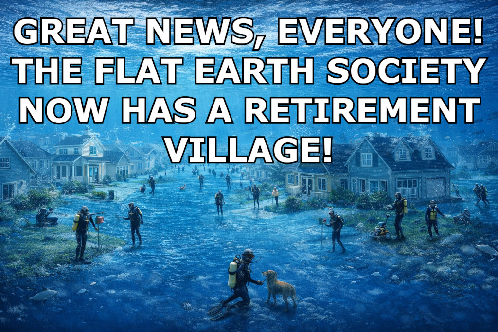
On the other hand since we live on Flat Earth I'm not even sure how we're
not all submerged. I'll get back to that later in a more fun section.
If you look at this file and couldn't already tell, there are a lot of jokes
(and some images, one of which I had fun making) in here and there are some in
the code too, particularly to do (in code) with Hollow and Flat Earth (and the
code is in a triangular shape because our Earth is also triangular, though the
comment in the code explains the map is of our Flat Rectangular Earth). The
reason for all this is because antipodes are fun so why not have fun in other
ways too?
I should guess that some of the shapes I have joked about I made up although I
wouldn't put it past others to have done so and I could imagine I could convince
people of their 'truth' (maybe I ought to start some new societies for them just
for laughs :-) ).
### Antipodal points
So what **really** are antipodal points? Well antipodal points [of a sphere]
are diametrically opposite each other. That is why the example I already gave
but another example is that if someone were to dig a hole anywhere in Iowa and
continued through they would eventually reach a point in the Indian Ocean (see
above). And in China it's a number of places but the usual example is Argentina
as you probably guessed (else open [china.ppm](china.ppm) which shows it on the
map from my program in fact).
I have included the **famous** and **gorgeous** Blue Marble Next Generation NASA
map as a PPM image as an image to draw on, though it's advisable to use a
different output filename so you can compare; as you'll see later I do allow you
to write on the source image: unlike many other tools with input and output
files being the same silently truncating the file.
In any case the program reads in the RAW data (WITHOUT a library!) into an
`unsigned char *`, modifies it and then writes it to a newly opened file (PLEASE
run this from the directory and don't specify a file that already exists! It was
too costly to check if the file already existed and to then report yet another
error).
No I do NOT use the `"b"` modifier. This is only for compatibility with ISO/IEC
9899:1990 ('ISO C90') and is ignored on POSIX systems (including macOS and
Linux). I do not support Windows and the contest is SUS/POSIX biased. I'm not
wasting a byte for Windows.
Note this map, seen below, is an **equirectangular** map and this is
**required** (in particular the width must be precisely `2*height`). It's
required because the NASA Blue Marble Next Generation map is and it uses
equirectangular projection maths, this program.
I do not support comments which I will get to later. However I do check for them
and exit with an error, assuming they're actually in the header (nothing I can
do otherwise).
Actually the statement that you'll eventually end up in China is only true in
South America (but see next point) and in particular Argentina: but not just
Argentina because China is approximately 3.5 larger than Argentina so there will
be antipodal points outside of Argentina that go into China; however it is the
usual example for the antipode of China and that's what I use in my included
maps and [try.sh](try.sh).
In no case, however, will you end up north of the equator if you dig (okay
obviously you wouldn't get that far but you know what I mean!) through the Earth
north of the equator and in no case will you end up in the eastern hemisphere if
you dig from the western hemisphere because the fact is the hemisphere is
flipped and so is the pole.
Below I talk about the type of map I have provided and calculations but how well
I can do that I guess we'll have to wait and see.
Anyway: yes this is a real thing. Most antipodal points end up in an ocean
(though many of those have their antipode on land). I've heard the Earth is
mostly water and most of that an ocean and I guess that's why (Landon will
inform me if I'm wrong :-), as [he's an astronomer](http://www.isthe.com/chongo/tech/astro/index.html),
and if this is true it causes a lot of problems for Flat Earth: just like magma chambers, lava
tubes [aka pyroducts and lava tunnels], volcanoes, sinkholes and many other
natural formations on and in (ah, maybe it is Hollow Earth! :-) ) our beautiful
Tetrahedral :-) Earth do.
On the other hand since we live on Flat Earth I'm not even sure how we're
not all submerged. I'll get back to that later in a more fun section.
If you look at this file and couldn't already tell, there are a lot of jokes
(and some images, one of which I had fun making) in here and there are some in
the code too, particularly to do (in code) with Hollow and Flat Earth (and the
code is in a triangular shape because our Earth is also triangular, though the
comment in the code explains the map is of our Flat Rectangular Earth). The
reason for all this is because antipodes are fun so why not have fun in other
ways too?
I should guess that some of the shapes I have joked about I made up although I
wouldn't put it past others to have done so and I could imagine I could convince
people of their 'truth' (maybe I ought to start some new societies for them just
for laughs :-) ).
### Antipodal points
So what **really** are antipodal points? Well antipodal points [of a sphere]
are diametrically opposite each other. That is why the example I already gave
but another example is that if someone were to dig a hole anywhere in Iowa and
continued through they would eventually reach a point in the Indian Ocean (see
above). And in China it's a number of places but the usual example is Argentina
as you probably guessed (else open [china.ppm](china.ppm) which shows it on the
map from my program in fact).
I have included the **famous** and **gorgeous** Blue Marble Next Generation NASA
map as a PPM image as an image to draw on, though it's advisable to use a
different output filename so you can compare; as you'll see later I do allow you
to write on the source image: unlike many other tools with input and output
files being the same silently truncating the file.
In any case the program reads in the RAW data (WITHOUT a library!) into an
`unsigned char *`, modifies it and then writes it to a newly opened file (PLEASE
run this from the directory and don't specify a file that already exists! It was
too costly to check if the file already existed and to then report yet another
error).
No I do NOT use the `"b"` modifier. This is only for compatibility with ISO/IEC
9899:1990 ('ISO C90') and is ignored on POSIX systems (including macOS and
Linux). I do not support Windows and the contest is SUS/POSIX biased. I'm not
wasting a byte for Windows.
Note this map, seen below, is an **equirectangular** map and this is
**required** (in particular the width must be precisely `2*height`). It's
required because the NASA Blue Marble Next Generation map is and it uses
equirectangular projection maths, this program.
I do not support comments which I will get to later. However I do check for them
and exit with an error, assuming they're actually in the header (nothing I can
do otherwise).
 If the image is NOT an equirectangular image then you will get an error message
(perhaps _Flat Earth_" although I originally had _"Pluto found"_ in a solemn
eulogy to [Pluto](https://en.wikipedia.org/wiki/Pluto) and maybe a
If the image is NOT an equirectangular image then you will get an error message
(perhaps _Flat Earth_" although I originally had _"Pluto found"_ in a solemn
eulogy to [Pluto](https://en.wikipedia.org/wiki/Pluto) and maybe a You know, just in case you forget what you're doing :-)
If you know you know and if you don't: look at the alt text of the image. Or
better yet use your crypto knowledge and translate this:
> m̄.rnlls esreuel seecJde
> sgtssmf unteief niedrke
> kt,samn atrateS Saodrrn
> emtnaeI nuaect rrilSa
> Atvaar .nscrc ieaabs
> ccdrmi eeutul frantu
> dt,iac oseibo KediiY
That is from one copy. I don't have the book in front of me to verify it and
unfortunately there are many bad translations. Oxford University Press is a good
one though.
But one copy of the book I have actually added text not in the original book AND
the main character was called different names at different times! In fact it
would appear that Gutenberg even has the name wrong; the character's name is
actually Axel and they have Harry. They have other things wrong as well, things
that are easy to verify as wrong. Let that be a warning to you all who rely on
Project Gutenberg to be always accurate: it's not.
Anyway after translating the above to Latin:
> In Sneffels Yokulis craterem kem delibat umbra Scartaris Julii intra calendas
descende, audas viator, et terrestre centrum attinges. Kod feci. Arne
Saknussemm.
...it will translates to English (I believe - there are some translations out
there that read 'Sneffels' in the English version but that is in the Rocky
Mountains; in fact they actually go to Snæfellsjökull in Iceland! - but this
seems more correct):
> Go down into the crater of Snæfellsjökull, which Scartaris's shadow
caresses just before the calends of July, O daring traveller, and you'll make it
to the centre of the earth. I've done so. Arne Saknussemm.
...although where I obtained the above it had Snæfellsjökull as two words: which
I don't remember and does not make sense to me. I don't know. Again the book is
not in front of me.
Anyway if you do go into the bowels of the Earth you might wish to start at the
[volcano at Snæfellsjökull](https://perlan.is/articles/snaefellsjokull-volcano).
Here is how you can get there from its antipodal point on Earth (yes I had to
make this smaller to fit - sorry):
You know, just in case you forget what you're doing :-)
If you know you know and if you don't: look at the alt text of the image. Or
better yet use your crypto knowledge and translate this:
> m̄.rnlls esreuel seecJde
> sgtssmf unteief niedrke
> kt,samn atrateS Saodrrn
> emtnaeI nuaect rrilSa
> Atvaar .nscrc ieaabs
> ccdrmi eeutul frantu
> dt,iac oseibo KediiY
That is from one copy. I don't have the book in front of me to verify it and
unfortunately there are many bad translations. Oxford University Press is a good
one though.
But one copy of the book I have actually added text not in the original book AND
the main character was called different names at different times! In fact it
would appear that Gutenberg even has the name wrong; the character's name is
actually Axel and they have Harry. They have other things wrong as well, things
that are easy to verify as wrong. Let that be a warning to you all who rely on
Project Gutenberg to be always accurate: it's not.
Anyway after translating the above to Latin:
> In Sneffels Yokulis craterem kem delibat umbra Scartaris Julii intra calendas
descende, audas viator, et terrestre centrum attinges. Kod feci. Arne
Saknussemm.
...it will translates to English (I believe - there are some translations out
there that read 'Sneffels' in the English version but that is in the Rocky
Mountains; in fact they actually go to Snæfellsjökull in Iceland! - but this
seems more correct):
> Go down into the crater of Snæfellsjökull, which Scartaris's shadow
caresses just before the calends of July, O daring traveller, and you'll make it
to the centre of the earth. I've done so. Arne Saknussemm.
...although where I obtained the above it had Snæfellsjökull as two words: which
I don't remember and does not make sense to me. I don't know. Again the book is
not in front of me.
Anyway if you do go into the bowels of the Earth you might wish to start at the
[volcano at Snæfellsjökull](https://perlan.is/articles/snaefellsjokull-volcano).
Here is how you can get there from its antipodal point on Earth (yes I had to
make this smaller to fit - sorry):
 ...assuming you can survive the frigid waters, lack of oxygen, all the gases,
the lava, the heat and the volcano itself, not to mention the dinosaurs and
other things they encountered.
Because you see you're not Axel or his uncle or their guide, although obviously
(!) it's a real story (some actually have asked if it's real: I saw on google in
'questions people ask' this very same thing!).
...but on the other hand on 18 June 2016 [there actually was a concert inside a
volcano in Iceland](https://www.bbc.co.uk/news/av/entertainment-arts-36571925)
(video)! Apparently through a lift system used for window cleaners (for
skyscrapers) they went down an astonishing 120 metres (400 feet) [into a magma
chamber](https://icelandmag.is/article/secret-solstice-organises-a-unique-concert-inside-a-volcano)
(!). That volcano was Þríhnúkagígar and apparently there have been many
performances since then and before, although that was the first concert.
Ah, so maybe our Earth really is hollow! :-) No no no. You see, it's flat. I
keep telling you this. Or maybe it's an upside down ball? It's all so very
confusing!
### Bonus feature
Unlike the **SERIOUSLY LIMITED (!)** shell, this program actually lets you use the
same input and output file WITHOUT making it empty!
I didn't want to limit your creativity (it can be fun to see a map with various
antipodal points plotted). It might be wise if you do this to do the first
plotting on a different image so you don't damage the original map but
nonetheless you can certainly do it without truncating the file. It was not that
hard. Honestly the shell has some explaining to do.
It is an exercise to the reader to make them in different colours but it's
actually pretty easy to do.
It might make a pretty little map. Actually I implemented a simple way to do
this in the Makefile (which took more bytes I might add) so that if a colour or
some colours don't work for one person they may use a different colour (or
colours) - one RGB value (R,G,B separate) for the source/origin (down arrow) and
one for the antipodal point (up arrow). Hopefully I didn't mix up the arrow
names (in the Makefile). I did that once at stupid o'clock but almost certain I
fixed it (\*HINT\* to the judges!). See also [Compiling](#compiling).
Another reason I allow you to write on the same file is because
[NOBODY IN THEIR RIGHT MIND would even THINK about running an IOCCC entry as
root](https://web.archive.org/web/20230314213743/https://en.wikipedia.org/wiki/International_Obfuscated_C_Code_Contest),
except for [2001/akari](https://www.ioccc.org/2011/akari/index.html)
(!!) and obviously [every other entry](https://www.ioccc.org/years.html)! Okay you get the
point. Be careful as always!
### [try.sh](%%REPO_URL%%/2025/ferguson/try.sh)
The try.sh script is quite extensive in what it shows you. I suggest you try
running it to see what I mean. Here are a few fun things though to give you an
idea of some.
#### Easter eggs
##### Chicxulub impact crater from 66Mya
Did you know that in 2013 February the number of years since the Chicxulub
impactor hit in the Yucatán peninsula (i.e., the catalyst to the
Cretaceous-Paleogene extinction i.e., the one that wiped out the dinosaurs aka
the worst crime in the history of the universe) was updated to 66Mya (66 million
years ago)?
If you were taught it was 65Mya then you can, assuming that you were alive
before February 2013, be happy to know that you're unique in a way that most
people (and let's be honest - nobody else in the future will experience this)
never will be: you lived during the transition of a million years from when the
dinosaurs were wiped out! And if you're still taught it: then the teacher (or
person) is behind times. Or maybe a time traveller?
And if you were alive before February 2013 you're probably freezing in an Ice
Age. And you're ancient. Obviously. Like me.
Anyway one of the things the [try.sh](%%REPO_URL%%/2025/ferguson/try.sh) script does has to do with the
Chicxulub impactor in the Yucatán peninsula (which for some reason the accent is
not appearing right in the script, possibly because of the terminal emulator but
probably this does not matter): it has you 'come out of' the crater, suggesting
you weep for the dinosaurs. Then it has you be the asteroid yourself (you
horrible, **horrible** person, you!!), asking you to look at what you did.
This is fun because it created a massive hole (obviously due to it being a
crater) which would be required to travel to the antipodal point (if you go
through the Earth - and see below).
This seemed a fun addition (added late) because if it was not pulverised you
could imagine that it could go deep into the Earth. Of course that's not how it
works but the point is it created a crater and the way one would get to an
antipodal point (again unless they have a plane or helicopter or some flying
machine that can take them to the precise coordinates) is by digging through the
Earth far enough (which they would never do).
**FUN FACT**: YES this does mean that if you do:
```
./prog 21.400000 -89.516700 earth.ppm asteroid.ppm
```
you will get the coordinates of where, if the asteroid did not blow up on
impact, and if it went all the way through the crust and up the ocean, where it
would end up! It will also show the arrows on asteroid.ppm. Fun little trivia to
be sure!
##### A mysterious thing :-)
Some of you might have noticed one of the runs of prog in try.sh:
```
./prog 34.95000 29.50000 earth.ppm mysterious.ppm
```
Why `mysterious.ppm`? Well I recommend you look at the image first. If you know
you'll know and appreciate it; otherwise look at what follows the command:
```
echo "Now open mysterious.ppm in a graphics viewer and please say hello to" 1>&2
echo "Captain Nemo for me!"
# and later on
echo "Now open mysterious_noclouds.ppm in a graphics viewer and say farewell to" 1>&2
echo "Captain Nemo for me." 1>&2
```
If you still don't know you very possibly never read The Mysterious Island by
Jules Verne (if you do wish to, which I recommend highly - as long as you get a
proper translation or the original French if you know French - I recommend you
read Twenty Thousand Leagues Under the Sea first, with the same caveat of a good
translation or in French).
Otherwise if you know you'll appreciate it when you open `mysterious.ppm` :-)
There is another fun message (actually a number of fun messages) in the try.sh
script as well and at least one or two should be obvious to most everyone if not
everyone; but the Mysterious Island nod is to those who have read the book (and
hopefully Twenty Thousand Leagues Under the Sea before that, unlike how it
happened with me: I did not know it came first until I got to the end of The
Mysterious Island).
##### Other Easter eggs in the try.sh script
Actually there is another Easter egg. Did you notice it? Well it so happens
there is an island called Null Island (okay so it's not real). If you guessed
its coordinates are 0,0 you're absolutely right :-) There are others in the code
if not also in try.sh (not sure).
The last script that try.sh asks you about is interesting. It is
[coords.sh](%%REPO_URL%%/2025/ferguson/coords.sh) and it spawns A LOT of processes. It is not run by
default. It will eat up resources and maybe inodes too. If you do run it I
suggest you open the target image (fun.ppm) in a graphics viewer early on,
either one which reloads it as it changes OR reopening it at different times. In
macOS you could do something like this from another shell: `open fun.ppm`. The
original idea was to test every coordinate but after it covered most of the
image I decided it was enough. Possibly it would not even need to have the full
range as each invocation will have more than one arrow, obviously.
There's another reference to a different book (in the code) as well but if
that's not seen by the judges I'd be shocked. Let's just say it's a little known
and short :-) book by a famous philologist.
I wasn't going to do this. I was going to have misleading variable names but
since those variable names are not actually used where you would expect them to
be there is no obfuscatory gains. Besides I already mentioned another character
(or somewhere in this file I did) in that world (well kind of inside that world;
the judges will know what I mean by that at least) so it fits better: plus that
world - well if you know you know. Finally on that it seems fitting to have a
story that takes place in a vast world to be referenced in the code of a program
that maps antipodal points.
#### Related Easter egg
Related to the Chicxulub impact crater Easter egg in my [try.sh](%%REPO_URL%%/2025/ferguson/try.sh) I
suggest you check google for 'Chicxulub'. Then wait a second or so once it
loads. It'll show an asteroid come down from the top left down to the bottom
right and then the screen will shake.
No clue if this is regional but I rediscovered it (I saw it years ago) by
accident some hours after I added it to the try.sh script. Hopefully it works
out for you.
See also this interesting article on the [Natural History Museum
website](https://www.nhm.ac.uk/discover/news/2024/august/dinosaur-killing-chicxulub-asteroid-came-from-edge-solar-system.html)
with more recent thoughts on the Chicxulub impactor and where it might have come
from and what it was made of. It's quite interesting!
BTW: why doesn't the British Museum have the Great Pyramids? Obviously because
they're too big to take (okay so that's mean but since we're talking about
museums :-) ... and it's also almost certainly true).
There are other interesting articles on that website such as
[Fossilised leg buried by dinosaur-killing asteroid uncovered in North America](https://www.nhm.ac.uk/discover/news/2022/april/fossilised-leg-buried-dinosaur-killing-asteroid-uncovered-north-america.html)
and various others; and [here is a fun
paper](https://www.nature.com/articles/s41467-020-15269-x) where they talk about
how the Chicxulub impactor was so powerful (or hit so powerfully) that ejecta
went back out into space, some never to return again!
I'm sure the IOCCC's resident astronomer (i.e., Landon :-) ) already knew these
and very possibly Leo knew them too but these are more new to me, though I have
been fascinated with dinosaurs since I was very young (just not enough to keep
up with everything, as other things such as [this](https://www.ioccc.org) and
[this](https://www.ioccc.org) and [this](https://www.ioccc.org) and
[this](https://www.ioccc.org) and [this all the way down](https://www.ioccc.org)
:-) are of higher priority).
### Even more humour
Besides elsewhere in this document and [try.sh](try.sh) here are some fun
images about the debunked and obviously totally bogus theory that the Earth is
flat (it's not - sorry to the Flat Earthers but you're utterly wrong; it's a
[Sierpiński triangle](https://en.wikipedia.org/wiki/Sierpiński_triangle)!) or
for those who wish to live in a non-flat Earth: a
[tetrahedron](https://en.wikipedia.org/wiki/Tetrahedron).
This is only to satirise (for a philosophical - in some senses of the word -
laugh, and also as it plays on my frequent back and forth with the Earth being
flat, hollow and other shapes and in reality neither) the Flat Earthers: if the
Earth is flat obviously there would be water on land and we might then question
if there is even land at all:
...assuming you can survive the frigid waters, lack of oxygen, all the gases,
the lava, the heat and the volcano itself, not to mention the dinosaurs and
other things they encountered.
Because you see you're not Axel or his uncle or their guide, although obviously
(!) it's a real story (some actually have asked if it's real: I saw on google in
'questions people ask' this very same thing!).
...but on the other hand on 18 June 2016 [there actually was a concert inside a
volcano in Iceland](https://www.bbc.co.uk/news/av/entertainment-arts-36571925)
(video)! Apparently through a lift system used for window cleaners (for
skyscrapers) they went down an astonishing 120 metres (400 feet) [into a magma
chamber](https://icelandmag.is/article/secret-solstice-organises-a-unique-concert-inside-a-volcano)
(!). That volcano was Þríhnúkagígar and apparently there have been many
performances since then and before, although that was the first concert.
Ah, so maybe our Earth really is hollow! :-) No no no. You see, it's flat. I
keep telling you this. Or maybe it's an upside down ball? It's all so very
confusing!
### Bonus feature
Unlike the **SERIOUSLY LIMITED (!)** shell, this program actually lets you use the
same input and output file WITHOUT making it empty!
I didn't want to limit your creativity (it can be fun to see a map with various
antipodal points plotted). It might be wise if you do this to do the first
plotting on a different image so you don't damage the original map but
nonetheless you can certainly do it without truncating the file. It was not that
hard. Honestly the shell has some explaining to do.
It is an exercise to the reader to make them in different colours but it's
actually pretty easy to do.
It might make a pretty little map. Actually I implemented a simple way to do
this in the Makefile (which took more bytes I might add) so that if a colour or
some colours don't work for one person they may use a different colour (or
colours) - one RGB value (R,G,B separate) for the source/origin (down arrow) and
one for the antipodal point (up arrow). Hopefully I didn't mix up the arrow
names (in the Makefile). I did that once at stupid o'clock but almost certain I
fixed it (\*HINT\* to the judges!). See also [Compiling](#compiling).
Another reason I allow you to write on the same file is because
[NOBODY IN THEIR RIGHT MIND would even THINK about running an IOCCC entry as
root](https://web.archive.org/web/20230314213743/https://en.wikipedia.org/wiki/International_Obfuscated_C_Code_Contest),
except for [2001/akari](https://www.ioccc.org/2011/akari/index.html)
(!!) and obviously [every other entry](https://www.ioccc.org/years.html)! Okay you get the
point. Be careful as always!
### [try.sh](%%REPO_URL%%/2025/ferguson/try.sh)
The try.sh script is quite extensive in what it shows you. I suggest you try
running it to see what I mean. Here are a few fun things though to give you an
idea of some.
#### Easter eggs
##### Chicxulub impact crater from 66Mya
Did you know that in 2013 February the number of years since the Chicxulub
impactor hit in the Yucatán peninsula (i.e., the catalyst to the
Cretaceous-Paleogene extinction i.e., the one that wiped out the dinosaurs aka
the worst crime in the history of the universe) was updated to 66Mya (66 million
years ago)?
If you were taught it was 65Mya then you can, assuming that you were alive
before February 2013, be happy to know that you're unique in a way that most
people (and let's be honest - nobody else in the future will experience this)
never will be: you lived during the transition of a million years from when the
dinosaurs were wiped out! And if you're still taught it: then the teacher (or
person) is behind times. Or maybe a time traveller?
And if you were alive before February 2013 you're probably freezing in an Ice
Age. And you're ancient. Obviously. Like me.
Anyway one of the things the [try.sh](%%REPO_URL%%/2025/ferguson/try.sh) script does has to do with the
Chicxulub impactor in the Yucatán peninsula (which for some reason the accent is
not appearing right in the script, possibly because of the terminal emulator but
probably this does not matter): it has you 'come out of' the crater, suggesting
you weep for the dinosaurs. Then it has you be the asteroid yourself (you
horrible, **horrible** person, you!!), asking you to look at what you did.
This is fun because it created a massive hole (obviously due to it being a
crater) which would be required to travel to the antipodal point (if you go
through the Earth - and see below).
This seemed a fun addition (added late) because if it was not pulverised you
could imagine that it could go deep into the Earth. Of course that's not how it
works but the point is it created a crater and the way one would get to an
antipodal point (again unless they have a plane or helicopter or some flying
machine that can take them to the precise coordinates) is by digging through the
Earth far enough (which they would never do).
**FUN FACT**: YES this does mean that if you do:
```
./prog 21.400000 -89.516700 earth.ppm asteroid.ppm
```
you will get the coordinates of where, if the asteroid did not blow up on
impact, and if it went all the way through the crust and up the ocean, where it
would end up! It will also show the arrows on asteroid.ppm. Fun little trivia to
be sure!
##### A mysterious thing :-)
Some of you might have noticed one of the runs of prog in try.sh:
```
./prog 34.95000 29.50000 earth.ppm mysterious.ppm
```
Why `mysterious.ppm`? Well I recommend you look at the image first. If you know
you'll know and appreciate it; otherwise look at what follows the command:
```
echo "Now open mysterious.ppm in a graphics viewer and please say hello to" 1>&2
echo "Captain Nemo for me!"
# and later on
echo "Now open mysterious_noclouds.ppm in a graphics viewer and say farewell to" 1>&2
echo "Captain Nemo for me." 1>&2
```
If you still don't know you very possibly never read The Mysterious Island by
Jules Verne (if you do wish to, which I recommend highly - as long as you get a
proper translation or the original French if you know French - I recommend you
read Twenty Thousand Leagues Under the Sea first, with the same caveat of a good
translation or in French).
Otherwise if you know you'll appreciate it when you open `mysterious.ppm` :-)
There is another fun message (actually a number of fun messages) in the try.sh
script as well and at least one or two should be obvious to most everyone if not
everyone; but the Mysterious Island nod is to those who have read the book (and
hopefully Twenty Thousand Leagues Under the Sea before that, unlike how it
happened with me: I did not know it came first until I got to the end of The
Mysterious Island).
##### Other Easter eggs in the try.sh script
Actually there is another Easter egg. Did you notice it? Well it so happens
there is an island called Null Island (okay so it's not real). If you guessed
its coordinates are 0,0 you're absolutely right :-) There are others in the code
if not also in try.sh (not sure).
The last script that try.sh asks you about is interesting. It is
[coords.sh](%%REPO_URL%%/2025/ferguson/coords.sh) and it spawns A LOT of processes. It is not run by
default. It will eat up resources and maybe inodes too. If you do run it I
suggest you open the target image (fun.ppm) in a graphics viewer early on,
either one which reloads it as it changes OR reopening it at different times. In
macOS you could do something like this from another shell: `open fun.ppm`. The
original idea was to test every coordinate but after it covered most of the
image I decided it was enough. Possibly it would not even need to have the full
range as each invocation will have more than one arrow, obviously.
There's another reference to a different book (in the code) as well but if
that's not seen by the judges I'd be shocked. Let's just say it's a little known
and short :-) book by a famous philologist.
I wasn't going to do this. I was going to have misleading variable names but
since those variable names are not actually used where you would expect them to
be there is no obfuscatory gains. Besides I already mentioned another character
(or somewhere in this file I did) in that world (well kind of inside that world;
the judges will know what I mean by that at least) so it fits better: plus that
world - well if you know you know. Finally on that it seems fitting to have a
story that takes place in a vast world to be referenced in the code of a program
that maps antipodal points.
#### Related Easter egg
Related to the Chicxulub impact crater Easter egg in my [try.sh](%%REPO_URL%%/2025/ferguson/try.sh) I
suggest you check google for 'Chicxulub'. Then wait a second or so once it
loads. It'll show an asteroid come down from the top left down to the bottom
right and then the screen will shake.
No clue if this is regional but I rediscovered it (I saw it years ago) by
accident some hours after I added it to the try.sh script. Hopefully it works
out for you.
See also this interesting article on the [Natural History Museum
website](https://www.nhm.ac.uk/discover/news/2024/august/dinosaur-killing-chicxulub-asteroid-came-from-edge-solar-system.html)
with more recent thoughts on the Chicxulub impactor and where it might have come
from and what it was made of. It's quite interesting!
BTW: why doesn't the British Museum have the Great Pyramids? Obviously because
they're too big to take (okay so that's mean but since we're talking about
museums :-) ... and it's also almost certainly true).
There are other interesting articles on that website such as
[Fossilised leg buried by dinosaur-killing asteroid uncovered in North America](https://www.nhm.ac.uk/discover/news/2022/april/fossilised-leg-buried-dinosaur-killing-asteroid-uncovered-north-america.html)
and various others; and [here is a fun
paper](https://www.nature.com/articles/s41467-020-15269-x) where they talk about
how the Chicxulub impactor was so powerful (or hit so powerfully) that ejecta
went back out into space, some never to return again!
I'm sure the IOCCC's resident astronomer (i.e., Landon :-) ) already knew these
and very possibly Leo knew them too but these are more new to me, though I have
been fascinated with dinosaurs since I was very young (just not enough to keep
up with everything, as other things such as [this](https://www.ioccc.org) and
[this](https://www.ioccc.org) and [this](https://www.ioccc.org) and
[this](https://www.ioccc.org) and [this all the way down](https://www.ioccc.org)
:-) are of higher priority).
### Even more humour
Besides elsewhere in this document and [try.sh](try.sh) here are some fun
images about the debunked and obviously totally bogus theory that the Earth is
flat (it's not - sorry to the Flat Earthers but you're utterly wrong; it's a
[Sierpiński triangle](https://en.wikipedia.org/wiki/Sierpiński_triangle)!) or
for those who wish to live in a non-flat Earth: a
[tetrahedron](https://en.wikipedia.org/wiki/Tetrahedron).
This is only to satirise (for a philosophical - in some senses of the word -
laugh, and also as it plays on my frequent back and forth with the Earth being
flat, hollow and other shapes and in reality neither) the Flat Earthers: if the
Earth is flat obviously there would be water on land and we might then question
if there is even land at all:
 Or perhaps this would help the Flat Earthers, assuming that the crust was thick
enough and it could pour out into space (which of course it isn't and doesn't,
which makes perfect sense since gravity also does not exist according to some
people, including I believe Flat Earthers)?
Or perhaps this would help the Flat Earthers, assuming that the crust was thick
enough and it could pour out into space (which of course it isn't and doesn't,
which makes perfect sense since gravity also does not exist according to some
people, including I believe Flat Earthers)?
 Well we'll never know because the Earth is not flat! You see if it was we would
have nothing on the Earth still, as this old meme that everyone and their cat
has seen shows:
Well we'll never know because the Earth is not flat! You see if it was we would
have nothing on the Earth still, as this old meme that everyone and their cat
has seen shows:
 Like I was saying it's a
#### How the arrows are rendered (for educational value \*HINT!\* :-) )
This section explains a great way to render arrows on an image in an obscure
way, though the obfuscation will make it rather hard to see. Still the little
program (see next paragraph) should show the general idea before it was
obfuscated to the bowels of our Hollow Earth.
For a simple piece of code that demonstrates the idea of how the
arrows are rendered, without worrying about the complexities
of the array (Flat Earth map, obviously - that's what it says
even and [obviously I would NEVER lie](obfuscation.md#lie)!) in
[prog.c](%%REPO_URL%%/2025/ferguson/prog.c), I have
included the [arrows.c](%%REPO_URL%%/2025/ferguson/arrows.c)
file. Simply run `make arrows && ./arrows` (and look at the code).
It's simple to understand: unlike (I hope) prog.c and its `m()` function (and
the set up and calling of it and worse of all the `S[][7]` map it uses for
multiple purposes, but primarily a map to say where a pixel should be drawn and
where nothing should be).
The [arrows.c](%%REPO_URL%%/2025/ferguson/arrows.c) file
has the array `S[][7]` that prog.c has, only smaller (fewer
rows) and much simpler: just zeros and ones and not interleaved. If you look at
the table you can see the shape of the arrows! Obviously this is wrong for
prog.c: very wrong and that's why it does not do this. Yet a map is obviously
the right choice, just numbers but some that are polymorphic in
[prog.c](%%REPO_URL%%/2025/ferguson/prog.c).
The [arrows.c](%%REPO_URL%%/2025/ferguson/arrows.c)
program will render in ASCII two arrows, up and down,
corresponding with the antipodal coordinate and the source coordinate,
respectively (that does not mean it calculates coordinates or does anything on a
map - it means the down arrow drawn is the source and the up arrow drawn is the
destination, except that it's ASCII only and not the same size, no colour etc.).
Although understanding prog.c will likely be far harder you can at least see how
arrows can be drawn from a simple table (or as the case is a much more complex
and cleverer table).
This is one of the educational values of the remarks and the submission in full
(\*HINT\* to judges).
BTW: yes the arrows in that file seem off in shape: two rows in each arrow have
the same width. But whether or not prog.c has that I personally cannot tell. It
does not look like it to me and it could be the characters used, even, in the
arrows file: not sure. Anyway you can at least get an idea there with how the
table was originally constructed. In fact that was the original table if I'm
thinking right!
More details are in [Obfuscation](#obfuscation) which has some general notes on
the [obfuscation.md](obfuscation.md) file which is full of lots of fun (or maybe
horrors). The section and file also bring up another program that shows lots of
debug output to show just how twisted the code is, if for no other reason but to
help the judges see why this might want to win (but maybe there are other
reasons - hard to know for sure because it's a lot of output; I certainly would
not want to try and parse what I have done or to rip apart the map).
#### Asides on the equator and the hemispheres
There's a fun fact from the first article (below) about Greenwich but I'll let
you find that out for yourself as the article uses maths like symbols and my
vision is too poor to really see those well (the context helps but I'd rather
just refer you to it instead).
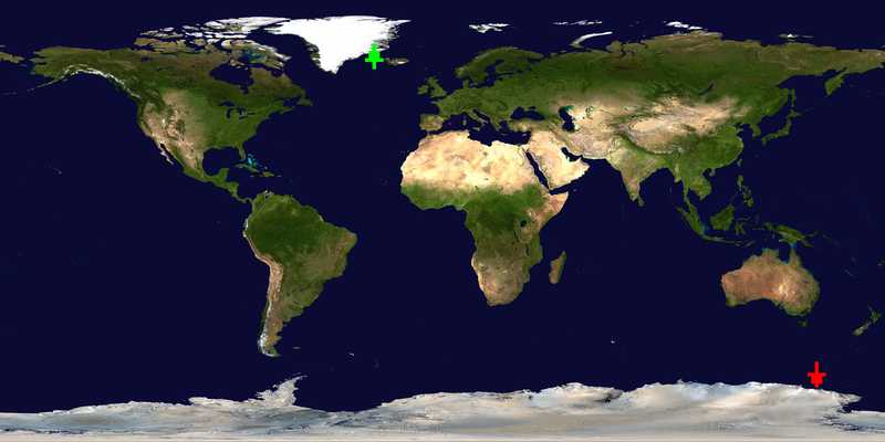
However that may be there is a place on Earth that is at both sides of the
equator (the fact above is to do with being on both hemispheres). It is in South
America also (remember that continent? If you're in Argentina and you dig
through the Earth far enough, which no scientists have been able to do, and
that's for the best, you would end up in China), which is funny to think about
as you might think it as 'south of the equator' (even though that's not what it
means).
Of course how scientists were able to dig only as far as they did when the Earth
is hollow is beyond me; and since it's also flat I can't understand how you can
possibly go from one equator to the other if you dig far enough through it. Of
course the fact it's flat and hollow would suggest [it's not even
real](https://en.wikipedia.org/wiki/Hallucination) (see also
[this](https://en.wikipedia.org/wiki/Simulation_hypothesis))!
Anyway these are in Ecuador. The first one is actually incorrect (it's an
article that includes the image and others too so that I have more bytes for
more fun maps) and can be found
[here](https://www.telegraph.co.uk/travel/lists/geographic-monuments-inaccurate-gps/)
(image is
[here](https://www.telegraph.co.uk/content/dam/Travel/2017/August/ecuador-GettyImages-5282439.jpg?imwidth=1920).
Now that one is according to GPS incorrect and the real location is about 243.84
metres (800 feet) away which can be found
[here](https://www.roadunraveled.com/wp-content/uploads/2018/06/equator-featured.jpg)
which is from [this
article](https://www.roadunraveled.com/blog/equator-tour-ecuador/) that claims
that that GPS (from officials) is wrong and instead the real location was
located by their GPS (funny wording if you know what GPS truly stands for).
That last article claims that it's at Quitsato Sundial; and we all know how
accurate the GPS always is! Clearly if more than one GPS states that the equator
is precisely at different spots we know at least one of them is lying. Maybe all
are even. I rather believe that an institute did better but given that the
monument is wrong and given the below fact who knows.
But of course...those who wish for this must contend with the unfortunate (to
them) fact that regardless of where it is our Flat Earth's continents shift,
land disappears, land forms etc., so even if you're at the equator right now in
the future it might not be. We might even say that the Earth...moves. Well
technically it does! You know it, I know it and everyone else knows it, except
for Flat Earthers and maybe a few other minorities.
Besides, people blindly following their GPS have ended up dead so it can't be
trusted completely anyway.
Anyway the monument and the other real location (the one with the sign located
at the last link) I first heard and saw on the TV programme Expedition Unknown
with archaeologist Josh Gates; the articles I found specifically for this
submission although I already knew about antipodes.
I originally included the images but I wanted to shrink the size of the
submission tarball so I could include something else more fun: regrettable but
worth it.
Oh BTW: Ecuador is apparently the Spanish word for 'equator'.
Now back to calculations.
#### Equirectangular calculations
Unfortunately I had made some errors at stupid o'clock and this section became
an unmanageable mess. Thus it might not be up to what I want. I'll hopefully be
able to explain a little bit though and clarify some things. This does not
explain how I sanitised out of range values.
This is about the arrows too so you need to keep that in mind too, especially
about the edges of the map. I'll get to that in a while though.
Here are details on lat/lon, to start out:
- Left edge = −180° longitude
- Right edge = +180° longitude
- Top edge = +90° latitude
- Bottom = −90° latitude
Here is old code when I used decimals, and I hope it gives you an idea for the
below discussion (in fact some of the discussion I had to remove as I no longer
knew what I was doing code wise and I was rushing; I am not a coordinates expert
and just knew enough but barely):
```
int lon_to_x(long lon, int width)
{
return (int)(((lon + 180000000L) * width) / 360000000L);
}
int lat_to_y(long lat, int height)
{
return (int)(((90000000L - lat) * height) / 180000000L);
}
void antipode(long lat, long lon, long *a_lat, long *a_lon)
{
*a_lat = -lat;
*a_lon = lon + 180000000L;
if (*a_lon > 180000000L)
*a_lon -= 360000000L;
}
```
But now it's floating point for reasons I make clear elsewhere (in
[obfuscation.html](obfuscation.html) because I wanted to stress how I went for
precision instead of supposed obfuscations with `long`s that would silently
truncate fractions).
Oh and yes I know that floating points have those other kinds of precision
issues. That is not what I am getting at; I am getting at the fact that in ints
these will all be 0:
```
0.0
0.111
0.755
etc.
```
As for micro degrees what I had originally:
```
1° = 1000000 micro degrees (that's 1m)
180° = 180000000
360° = 360000000
```
Notice also how 180 is half of 360 and the scale of the image is 2:1 (and
earth.ppm is 1200 x 600 width x height).
And yes latitude spans half a circle, antipodes cross the equator (and then go
on the other side as well) and this is why 180° is so important.
Where do 180 and 360 really come from? It is geography.
- Longitude runs from −180 to +180 for a total range of 360.
- Latitude runs from +90 to -90 for a total range of 180.
Hence 360 and 180 which is why antipodes rely on it. With antipodes you must
have 180 and 360. The fact our Earth is a Flat Globe is why I had to do
wraparound in out of range coordinates (as I said this step is missing from
at least some calculations by which I guess I mean in this section of the
remarks) but the globe part is why the 180 and 360.
So why does latitude use 90 in our mapping? Because latitude range is +90 to -90
and images start at the top left corner. Image coordinates are flipped so we
must shift latitude like thus:
```
+90 is the top of the image.
−90 is the bottom of the image.
```
The formula I am using is equirectangular projection maths.
- Longitude maps linearly from left to right (since our Earth is flat there is
no wraparound, you see. At least...once the dinosaurs were murdered by a stupid
asteroid it became flat :-) ).
- Latitude maps linearly from the top to the bottom (and just like longitude,
because our Earth is flat, there was no wraparound, not until I decided to be
what I believe is more faithful to our
[Cuboctahedron Earth](https://en.wikipedia.org/wiki/Cuboctahedron) :-) ).
The general formulas (if I'm thinking right right now):
```
x = `(longitude + 180) / 360 * image_width-1`.
y = `(90 − latitude) / 180 * image_height-1`.
```
...except that as you'll see on the edges I have to do something special, so the
arrows will fit (otherwise they'd be partly off the map, kind of like what
happens if our Earth was truly flat and we went to the edge: we'd just tip off
it and fall 'into' space, assuming we didn't drown first, which of course we
would have since the planet would be drowned). In other words at the edges it's
shifted by more than one for the arrows.
You saw the antipode calculations earlier. That's it.
As for the arrows fitting on the map: I do have to push them further on the map
so the `- 1` is only true in a sense (it'd be hardly an arrow if it was at the
edge); again this is an example of how it MUST be an approximation. It also
applies on all sides: north, south, east and west. I detail that elsewhere in
more detail.
##### Determining coordinates (and a tool to convert DMS coordinates to regular coordinates)
First of all as far as the decimal coordinates (which is the form prog.c deals
with, for reasons that should be obvious in a moment, though that does not mean
the program does not use floating point: I mean the type of coordinate format),
remember that for latitude:
- if north of the equator: coordinate is positive;
- else if south of the equator: coordinate is negative;
- else coordinate is 0 (which brings up the philosophical question of which side
of the equator is it really).
...and for the longitude:
- if in the western hemisphere: coordinate is negative;
- else if in the eastern hemisphere: coordinate is positive;
- else longitude is 0 (which brings up a rather philosophical question of which
hemisphere it REALLY is in).
That is an important point because some sources forget the sign and that caused
me issues.
However there is at least one other system, the so called DMS: degree minute
second coordinates. For this I offer a tool to convert them to decimal
coordinates. To use:
```
make dms
./dms deg min sec [S|N] deg min sec [W|E]
./dms deg min sec [S|N|W|E]
```
where the first invocation has two sets: the lat and lon of the coordinates. The
second invocation allows you to have a single lat or lon coordinate.
An example use in [dms.c](%%REPO_URL%%/2025/ferguson/dms.c):
```
# after make dms
$ ./dms 24 29 10 S 46 40 30 W
-24.48611 -46.67500
```
How do you know when you have that format? It should look something like:
> 24°29′10″S, 46°40′30″W
Obviously remove the comma and the degree (`°`), minute (`'` or else `′`) and
second (`"` or `″`) symbols.
Although it appears okay, I do not make any promises that it is 100% accurate as
I am not an expert with coordinates: I just know enough geography and enough of
equirectangular projection (with some research of course) to write
[prog.c](%%REPO_URL%%/2025/ferguson/prog.c) that draws the arrows (antipodal up and source down) on a PPM
equirectangular map of our gorgeous Flat Earth. And as it is I had some
troubles with integrating wraparound, hence [test.sh](%%REPO_URL%%/2025/ferguson/test.sh) and more so
[antipode.c](%%REPO_URL%%/2025/ferguson/antipode.c)!
Those coordinates, incidentally, the 24°29′10″S 46°40′30″W (-24.48611 -46.67500)
are in the [try.sh](try.sh) script and I used the tool to do the conversion.
Previously the tool (`dms.c`) only supported one hemisphere and equator and it
worked for the original test but when I needed to find those other coordinates,
which were sourced wrong (they were missing the sign), I decided to update the
tool which is both an enhancement and a bug fix. That was not enough: I added
the second invocation as well.
Oh and yes. I'm sure there is some reason behind it, maybe earlier navigation
before the Earth was roundish, but it still feels to me like the person who
created that system had quite lost it, maybe from being on the Sea too long. The
question is whether I lost the plot with them, and did it wrong.
### A homage to Brian Westley's 1992/westley mapper
Incidentally here's an example with 1992/westley on China and Argentina, taken
from my [westley.sh](%%REPO_URL%%/2025/ferguson/westley.sh) script which uses my program to show antipodes
(using the simpler invocation of my program) along with his (some changes were
made, apologies if it does not exactly match it - which might also depend on
your screen width):
```
Press any key to show coords 40 117 (China) on the map (from 1992/westley):
!!!!!!!!!!! !!! !!! !!!!!!!
! !!!!!!!!!!!!!!!!! !!!!! ! ! !!!!!!!!!!!!!!!!!!!!!!!!!!!!!!!!!
!!!!!!!!!!!!!!!!!!! !!!! ! !! !!!!!!!!!!!!!!!!!!!!!!!!!!!!!!
!!!!!!!!!!!!!! !!!!!!! !!!!!!!!!!!!!!!"! !! !
!!!!!!!!! !! ! !!!!!!!!!!!!!!!!!!!! !
! !!!! ! !!!!!!!!!!!!!!!!!!!!!!!!!!
!!!!! !!!!!!!!!!!!! !!! !!! !
!!!!! !!!!!!!!!! ! ! ! !
!!!!!!!! !!!!! !!
!!!!!! !!!! ! !!!!!
!!!! !! !!!!!!!!
!! !! !! !
!
Press any key to run: ./prog 40 117:
-40.000000 -63.000000
Press any key to run: ./westley -40.000000 -63.000000 (show Argentina):
!!!!!!!!!!! !!! !!! !!!!!!!
! !!!!!!!!!!!!!!!!! !!!!! ! ! !!!!!!!!!!!!!!!!!!!!!!!!!!!!!!!!!
!!!!!!!!!!!!!!!!!!! !!!! ! !! !!!!!!!!!!!!!!!!!!!!!!!!!!!!!!
!!!!!!!!!!!!!! !!!!!!! !!!!!!!!!!!!!!!!! !! !
!!!!!!!!! !! ! !!!!!!!!!!!!!!!!!!!! !
! !!!! ! !!!!!!!!!!!!!!!!!!!!!!!!!!
!!!!! !!!!!!!!!!!!! !!! !!! !
!!!!! !!!!!!!!!! ! ! ! !
!!!!!!!! !!!!! !!
!!!!!! !!!! ! !!!!!
!!!! !! !!!!!!!!
!" !! !! !
!
Press any key to show coords -40 -63 (Argentina) on the map (from 1992/westley):
!!!!!!!!!!! !!! !!! !!!!!!!
! !!!!!!!!!!!!!!!!! !!!!! ! ! !!!!!!!!!!!!!!!!!!!!!!!!!!!!!!!!!
!!!!!!!!!!!!!!!!!!! !!!! ! !! !!!!!!!!!!!!!!!!!!!!!!!!!!!!!!
!!!!!!!!!!!!!! !!!!!!! !!!!!!!!!!!!!!!!! !! !
!!!!!!!!! !! ! !!!!!!!!!!!!!!!!!!!! !
! !!!! ! !!!!!!!!!!!!!!!!!!!!!!!!!!
!!!!! !!!!!!!!!!!!! !!! !!! !
!!!!! !!!!!!!!!! ! ! ! !
!!!!!!!! !!!!! !!
!!!!!! !!!! ! !!!!!
!!!! !! !!!!!!!!
!" !! !! !
!
Press any key to run: ./prog -40 -63:
40.000000 117.000000
Press any key to run: ./westley 40.000000 117.000000 (show China):
!!!!!!!!!!! !!! !!! !!!!!!!
! !!!!!!!!!!!!!!!!! !!!!! ! ! !!!!!!!!!!!!!!!!!!!!!!!!!!!!!!!!!
!!!!!!!!!!!!!!!!!!! !!!! ! !! !!!!!!!!!!!!!!!!!!!!!!!!!!!!!!
!!!!!!!!!!!!!! !!!!!!! !!!!!!!!!!!!!!!"! !! !
!!!!!!!!! !! ! !!!!!!!!!!!!!!!!!!!! !
! !!!! ! !!!!!!!!!!!!!!!!!!!!!!!!!!
!!!!! !!!!!!!!!!!!! !!! !!! !
!!!!! !!!!!!!!!! ! ! ! !
!!!!!!!! !!!!! !!
!!!!!! !!!! ! !!!!!
!!!! !! !!!!!!!!
!! !! !! !
!
```
The [try.sh](%%REPO_URL%%/2025/ferguson/try.sh) asks if you wish to run the script and if there is any
pasting error or inconsistency the script should be right anyway.
As I said somewhere his entry does not support floating points (though it's
still brilliant!) so if fractions were given it would be truncated, causing some
problems when a lat/lon are truncated e.g. (and I did not test how much of a
problem this is - this is just an example) 0.9 0.8), which is another reason I
chose floating points.
I think this is a great tribute to that brilliant entry (and all of his entries
were brilliant) and I hope the judges enjoy it too! As you probably noticed: I
use those coordinates in my [try.sh](%%REPO_URL%%/2025/ferguson/try.sh) as they're a common example given
with antipodes (maybe because of the myth that if you dig down far enough you'll
eventually end up in China, despite the fact this only is true in a certain part
of the world).
### Obfuscation
See the [obfuscation.html](obfuscation.html) file for some fun obfuscation nodes.
#### On the markdown file
Regarding [obfuscation.md](obfuscation.md)"
There is table abuse but it's rather unique in a lot of ways. The primary
purpose of it is to tell the program HOW to draw arrows (interestingly by arrows
themselves!) and I believe also partly WHEN to draw arrows (I'm less clear on
this part now). But it does a lot more than that. It has real life coordinates
(because how could it not?) and this means I had to carefully construct it so it
does not break. There are three or four rows that are not full of coordinates
but are still used in different ways.
Actually the first 14 rows also have some cells that are used in multiple ways:
which means the coordinates, which are NOT random coordinates (I'll talk about
this in the other file), had to be worked into the code.
The remaining rows might or might not have coordinates.
There are a few levels of indirection in a few places but that's a lesser
matter. Actually what makes that (and other access) rather formidable is the
cells are accessed dynamically based on other values, including a value that is
rather amusing with some misleading comments and some very funny code.
I have even used the Makefile as part of obfuscation but in a unique way: the
code challenges you to try changing something but because depending on what you
change it to (and at this point you'll already see a comment was telling the
truth to start out) it can trigger a warning that is too revealing I put in the
Makefile a `-Wno-`! That way you have to compile it manually in order to figure
out what is going on.
I'd rather not tell you that but I also don't want you to miss it. I don't think
this has ever been done in the IOCCC but it's certainly rarer.
I use NO library to manipulate the images. I read it into an `unsigned char *`
that is allocated through `calloc()` based on the image header. This makes it
more portable and also offers lots of opportunities for fun obfuscations and
other things.
There is code that might seem useless and it might in theory be but it's there
to mislead and for the side-effects.
As for the table in the first 14 rows: non-zero cells are to be drawn and cells
with zero are not to be drawn but that does not mean 0 is meaningless in every
cell. I included a program that prints out LOTS of debug information to show you
how well things are concealed and in fact with the `-d` option with
[earth.ppm](earth.ppm) it created a log file over 2MB. This is because it prints
the table frequently with that option.
It also is a gatekeeper to the fscanf() call in rather amusing ways. OTHER
variables that are indirectly passed into the function (not as parameters but
still 'passed' in via comma operator, and per call some variables change) which
also help in selecting cells along with the table cell controls code: whether to
run or not. Then because of that the fscanf() might or might not run. It is not
easy to follow the way the table is used as I think you'll both see and rather
enjoy!
The table works in many ways all together and the best part is it's simply
`long`s. It's simply what was once two arrays flattened into a `long S[][7]`.
I actually offer you [unformatted.c](%%REPO_URL%%/2025/ferguson/unformatted.c) so you can see what the
table use is really like and how it's quite a variety of things even though it's
just an array of `long`s.
Actually the table/map is a nightmare but it's not in the usual ways that you
might expect and combined it's really nasty. The fact the main purpose is the
pixel/coordinate arrow drawing and yet the other uses (and including cells)
control some of that (and it controls fscanf()) is rather amusing.
As I note in the [obfuscation.md](obfuscation.md) file I **HIGHLY RECOMMEND**
you look at the [debug.c](%%REPO_URL%%/2025/ferguson/debug.c) file's output; it is like prog.c but with A
LOT of debug output (originally called something else; use `-d` for even more
output) so you can truly appreciate just how twisted this code is
and how many expressions there are, how many 'mutations' (not really the right
word but I can't think of anything better) there are, all the while
without breaking the coordinates (and thus the code), though as you'll learn
this might not be all that it seems. Nonetheless they do work together and cells
do change but it's hard to be sure which ones. All carefully given values that
work but based on real non-random coordinates. Not all change and I'm honestly
not even sure which ones change.
The debug.c output shows just how much there is to keep track of. The data is
interleaved in two ways. And yes I could have just done `1` and `0` but where is
the fun in that? This is an antipode mapper so it MUST have coordinates in the
table!
It is diabolically designed where cells might change at times and yet magically
they're never an invalid value even if changed. That might (not sure) be where
they go from non-zero to zero and vice versa or not. I think not but that does
not matter. What matters is it probably is not easy to tell.
Obviously not using a library is a gain - libnetpbm would be far too revealing
and far less
[arcane](https://magicsystems.fandom.com/wiki/Arcane_Magic_(Dungeons_%26_Dragons)).
Also as I noted in the [how the arrows are rendered section](#rendering) if you
wish to see in a MUCH simpler way the general CONCEPT of how the arrows are
drawn, as well as how the code knows whether to draw a pixel or not, see
[arrows.c](%%REPO_URL%%/2025/ferguson/arrows.c) though obviously that code will not show you the
equirectangular projections. As I noted [here](#floating) this program requires
floating points/negative 0 but I first wrote [small.c](%%REPO_URL%%/2025/ferguson/small.c) which is buggy
(due to `long`s) but which also has much smaller arrows (args order is swapped).
This file does let you see the plotting algorithm better with the caveat that
it's buggy and probably clamps the values rather than do wraparound.
You can compile arrows.c with `make arrows`. It is a simple piece of code that
simply draws an ASCII arrow (or arrows) based on the much simpler table (ones
and zeros only, no real life coordinates etc.). Compared to arrows.c the map in
prog.c is FAR MORE interesting.
Obviously as the table is a map for images that are maps (presumably) of the
Earth without a library the fact is indirection had to happen and obviously real
coordinates had to be put in the table even though I could have just put 0s and
1s. The map makes or breaks everything yet the map is changing, kind of like the
Earth, only this map changes more rapidly, maybe.
I think you'll enjoy the misleading comments and what I have done with `d` where
I help you prove to YOURSELF that I'm not lying but of course I am. This helps
you learn what the value is even though I need it to be something else. Yes this
is related to the Makefile trickery!
It's rather well-rounded in obfuscation.
The fact that the table is a map that says how to draw a pixel on the image (and
maybe when to draw) is why the joke comment is there, or at least one of the
reasons.
That is the chief purpose of the array but since I had to have numbers why not
take advantage of it (and include real coordinates)? Only numbers and a map: of
course it had to be coordinates, regardless of how many functions they have
(though again the last three or four cells might not have selected coordinates -
I don't know now).
It's interesting, maybe (or maybe not?), that despite the fact the table is
relatively small, and that especially goes with only 7 columns, it deals with
larger images fine. If you can figure out why this is: great but can you figure
out the ordering of the numbers and how I had to carefully create the numbers
(as real life coordinates in most cases) without breaking code even when it's
mutated (the other questions are which cells are mutated and which are not? And
how are they abused? Etc.)?
That's ONE OF the REAL sneaky things about the table: it's interleaved to make
it hard to find the arrow shapes and it's used in multiple ways and constructed
carefully so code does not break even after mutation (however as you'll learn I
am not sure if the first 14 rows are mutated or not: I don't know what to trust
now due to the madness).
In any case without the constraints put in place the code would break. It would
also try `fscanf()` on a write-only file which is undefined; [debug.c](%%REPO_URL%%/2025/ferguson/debug.c)
can help show that it should be correct but I'll talk more about that in
[obfuscation.md](obfuscation.md). All because of the coordinates in the table!
It might or might not be that cells that control the drawing are mutated but
what is certain is that those non-zero values are used (or some are) in multiple
ways beyond just how (and maybe when) to draw. I believe some of the cells with
0 in the first 14 rows might also be used, at least some of them.
The table is interesting in a lot of ways which you'll see.
If you do not see this (the interleaving and other things complicating it all)
then observe [debug.c](%%REPO_URL%%/2025/ferguson/debug.c) output. As you can see it heavily mutates and
takes different addresses at different times and still functions; it's not just
constant addresses but rather it varies from call to call even though in some
cases I could have got away with keeping them the same (not in all though as in
the case of `fscanf()` protection, which again I hope and believe is still
correct: you'll see).
As you can see from that file also the expressions are also a key: not just
indirection of the map but many hard expressions that dynamically use the map
that can only be mutated in some places (and is) but yet still function
properly.
As for the table mutation: that is one of the nice things. This is not
traditional table abuse; it's more than that. One of the nasty things is that
you can't rely on the values other than to know that they are the correct value
at all times, even if only right before it's needed. And yet...you might not
trust even that because of what I have done with comments.
Mutation might not even be the most precise word. Nonetheless dynamically
selected cells do change values. This means 0 becomes non-zero and probably vice
versa. I can't say which ones are modified: not truly, not even with debug.c, as
it's quite possible something was missed.
On the other hand there are cells that do not matter at all (in some or all
ways?), which also might mean something! There is that Easter egg in there too.
To make a joke on this: I am not competing for something silly like 'best abuse
of tables'. MAYBE (but not really) 'best abuse of our Flat Tetrahedral Earth'
:-) or more meanly and more aptly 'Best Abuse of the Flat Earth Society' :-)
which I kind of am doing (and it's a reward I'd love but I leave that to you,
assuming there's no other submission that takes the piss out of the Flat Earth
Society in another way: and if there is I'll go for something else :-) ).
I believe this is a beautiful program that shows the perhaps lesser known
antipodal concept on the famous GORGEOUS Blue Marble Next Generation map
(\*HINT to Landon! :-)\*) - or any other map that one chooses to use if
equirectangular - by directly manipulating the pixels based on coordinates in
the map (not sure if this means the table or the image now, since both have
coordinates: sorry) WITHOUT A LIBRARY: and what else could be more on theme than
using a 'map' for that?
But the things above in this section and in the obfuscation file all add up of
course.
### On layout and naming
First of all: there is [unformatted.c](%%REPO_URL%%/2025/ferguson/unformatted.c) which is what it looked
like before I turned it into our Triangular Earth in shape. Hopefully the last
bug fix was carried over (same goes for debug.c) - it was the out of range
coordinates being clamped instead of wrapping. A quick look suggests that it was
at least attempted in these files but I think I got it in both.
There also are two other formats that are fun. The upside down triangle was a
joke too but unfortunately I can't have it be 'perfect' as the `fscanf()` format
is too long and if I added `"` it would be even more bytes. In truth as a
different file, [prog.upside.down.c](%%REPO_URL%%/2025/ferguson/prog.upside.down.c), I could do it properly
but I was tired of fighting it and it's good enough as it's not my submission
anyway. No this one does NOT have the bug fix. It is not my submission.
The other one is [prog.right.c](%%REPO_URL%%/2025/ferguson/prog.right.c) which reminds
me more of a right-angled triangle. Maybe not quite right but it's what it
reminded me of. And as for why I don't want it even though it looks nice it's
because the top comment, the dare comment, it looks badly aligned. So I went
with the format in prog.c. This one also does not have the bug fix. It is not my
submission and I didn't have time to do this here with the formatting: just like
the upside down one.
This new shape in prog.c, the triangle (really the only one that works even),
ruined some of the things like spelling MAP vertically but I leave that
discussion here because it's in the unformatted code and because you can still
find the variables there if you look and imagine it well enough (see also the
spelling out of GPS, amongst other things perhaps).
It is not clear if the final obfuscations made it to the unformatted code (I
think it did and I think the final bug fix did too) and I did not test run it
either the last time (well I might have - not sure). Nonetheless it should be
enough to give you an idea. Actually I would recommend you use a beautifier
personally: that would be easier but I'll not include one because this way you
can use your beautifier of choice.
I'm not sure it's going to help all that much with everything but it might at
least make it a bit easier to see everything. Who knows?
Now with that note out of the way.
I hope you saw that I spelt out things related to maps and coordinates. I
mentioned GPS already. Earlier on the `S` variable was a double floating point
'for coordinates' but since I don't use the fraction there and since I wanted to
use it for other mischief it's now a `long` as well (IIRC, I use it as pointers
too but maybe not - and obviously that would not be legal if it's what I am
thinking I do).
But obviously it still has coordinates but to save bytes I don't always use the
full number (backwards of course, usually) - that and to make it less obvious.
Instead since there are enough non-zeros needed I just continue the digits in
the next non-zero cell (as noted elsewhere I also repurpose cells that could not
be used, just for an Easter egg).
It's fun that it has coordinates (including that mandatory Easter egg that I
hinted at plus the Antipodes Island coordinates in an array that draws arrows on
a map including antipodal coordinates) because this table actually is what is
used to draw arrows based on [antipodal] coordinates! These coordinates do
matter in their way but strictly in the sense that the specific cells are not 0.
Another example is the `m()` function; the three three args: `a`, `p` and
`s` to spell out maps. Which BTW: maps spelt backwards is spam so when you look
at my program I highly recommend you watch Monty Python Spam. Probably should
not eat spam though: it's extremely unhealthy. But if you're feeling like being
in theme you might want to eat it anyway.
In that same function `m()` it also spells out `MAP` vertically (again not in
the formatted code but you can still see it if you read it carefully). Obviously
this is a double reference to the representation of our Flat Earth.
Okay but you have to admit that most maps are flat so the question is if the
Earth is not flat how accurate are the maps? (That is not an argument I have
heard from Flat Earthers but I would not be surprised if some have pointed it
out anyway. I kind of hope it is one they use though because it would be funny.)
Did you see the joke comments? There are three parts to this. It looks like
this:
```
// Map of our Flat Earth
```
At one point it said 'Map our Flat Earth' and after that it said 'Our Flat Earth
Map' but since this is a 'map' (with coordinates and used for arrows and other
things) I changed it. The latter two sentences are anagrams anyway but I felt
like having the 'of' helped it out more: not only the joke but in general.
That's great enough: talking about the map of our Flat Earth only to have the
code shaped like a triangle. But then there also are two error messages that are
not 'normal': 'Flat Earth' and 'Hollow Earth'. Why Hollow Earth? Because if
there is a write error it's likely that the file is shorter so 'empty' or
'hollow'.
And Flat Earth? Because if the source file (okay obviously I don't mean prog.c
but you know what I mean!) has an error in reading then it must be a 'flat'
file.
Which is meant to suggest that the Earth is both Flat and Hollow. But of course
as you just saw it's triangular and as I said earlier it's a
### 'Bugs' / 'Limitations'
### Floating point
This program requires floating point. This is because it needs negative 0.
Without this antipodes will be broken. See [small.c](%%REPO_URL%%/2025/ferguson/small.c). Try it like:
```
make small
./small earth.ppm foo.ppm 0 0
```
The arrows will be on the wrong side of the map! The antipode lat of 0 is -0 but
with `long` this is not possible. That program small.c also has really small
arrows (hence the name :-) ) and it's one of the reasons I made the arrows in
prog.c much larger.
Additionally without floating point the coordinates 0 0 will be the same as
0.999 0.999 due to truncation. With coordinates this is NOT a good thing.
The entry I paid homage to is great but it is by int so numbers were truncated
and unless if by some trick (which honestly would not surprise me with Brian
Westley) it would not work in every case (the fact it did go left, right, up and
down makes me think he did manage something sneaky but it still had no choice
but to truncate numbers).
So floating points are required and negative 0 is obviously required too because
of how antipodes work.
### The problem with colours
I put a workaround in via the Makefile (see [Compiling](#compiling)) but I want
to explain the issue here.
I already said the green and red analogy but there is actually another issue
depending on the person. Finding the right colour is impossible to satisfy
everyone even if I diverge from the green/red analogy. Some people probably
don't like the shade of red even though it probably can be seen everywhere on
the map. Unless they can't see red of course, or some other issue makes red not
work for them (and then whatever they see or do not see also does not work).
The green value I have (0,255,0) works in most places but this will depend on
the person probably more than red.
Contrast however is also an issue that I cannot solve. That ALMOST makes the
arrows less useful but not quite. They're not ONLY visual cues as I said but
that is nice when the contrast is good [enough]. Besides that, if you can at
least see the tip that is helpful, and making it bigger helps. A diamond or some
other shape would be useless with that!
Here are some examples of contrast being an issue, to give you an idea, though
some I'm sure you already thought of.
If I chose white it would show up in some places but it would be impossible or
almost impossible to see on ice and in clouds so that's a pass.
If I chose magenta it MIGHT be easier to see in some places (but not necessarily
in every place, though MAYBE better than green) but that would also be a bit too
close to red (same with purple although that MIGHT be better). It might also be
too bright for some people (maybe almost as bad as yellow but again that will
depend on the person).
Blue obviously would be a bad idea for the ocean. Well dark blue CAN work but
it's hard to see (for me) and it would also be difficult in some other parts.
Darker green is harder to see (for me if nobody else and I have to not assume
that others won't have the problem even if my vision is absolute rubbish,
because many do).
The point is there is no perfect colour and this is why I allow one to
reconfigure it (except in the try.sh and test.sh scripts because doing so would
mean the comparison of images could break). Contrast and personal perception and
vision in general, that will make a difference and this always holds, here and
everywhere else, except perhaps when you're far away from any light, or maybe in
an black hole, if you somehow actually surprised.
Even black might not work in every part of the world, though I haven't tested
this.
This is unfortunate but I think what I did is a nice compromise, especially as
green works in most places and red works in probably every place on the map I
chose (the Blue Marble Next Generation with clouds; without clouds 0,255,0 is a
bit better but not all that different except in some places), again except for
people who have a problem with red.
It's not perfect but no matter what colours are chosen, it will likely not work
for some people so it's almost pointless to even try.
Nonetheless I gave it my best go to find a reasonable value that contrasts well
in much of the map. But even that will depend on the person so there is no
winning here. But I'll return to [how to reconfigure colours a bit
later](#compiling).
### Humour / FAQ
First of all, before I get to nonsense like how our Earth is globular (and again
to those who want to take me serious please do not do so - I am not at all
serious: it is tetrahedron as I keep telling you) I want to point out the jokes
in the code.
If there is a write error on the file then it shows '[Hollow
Earth'](https://en.wikipedia.org/wiki/Hollow_Earth) (okay so it does not show the
link). This is because the file will not be full so it's 'hollow'.
If however there is a read error, say due to an invalid header (including a
comment in the header in a bad place - see earlier in this file for what I mean,
or maybe [comments.md](comments.md)) or some other reason, it will show 'Flat
Earth': indicating there is an error in the file. What better way could it be
than to say Flat Earth, an error in logic?
On the other hand if a file cannot be opened I do a more useful error message,
namely `open %s failed` where obviously `%s` is the path to the file. But now
for some nonsense.
BTW, fun fact: even though our Earth is hollow, even NASA claims that it's flat!
Don't believe me? I quote from the Blue Marble Next Generation page, first for
the one with clouds (which is [earth.ppm](earth.ppm), though they do not offer
it in PPM format):
> Flat Earth still
...and for the one without clouds:
> Flat Earth still (no clouds)
...so maybe the Flat Earthers are right after all? I think not. We obviously
live on a Hollow Tetrahedral Earth! :-)
Did you know that a paper released out of HARVARD University posits that aliens
might be living amongst us or in a secret base on the Moon? Search google for
something like: 'A new paper suggests extraterrestrials could also be living
underground or in a base inside the Moon.'. Where these imaginary creatures come
from, whether intelligent dinosaurs, the future, or whether or not they're
faeries, these were looked at too it would appear.
I wish I was making this up. No. Actually I am glad I am not making this up. I
have seen other crazy things as well like scientists being concerned we might
infect alien 'computers' with viruses (it would appear to me they saw
Independence Day more than is good for them, even though Hollywood did not get
things right, shocking as it is, using multiple terms).
'Virus' is not at all the word I would use when describing infecting of
extraterrestrials, assuming that they actually existed, though. And computers
are a human thing so that issue is also nonsense.
This one is also funny:
 That comes from John Cleves Symmes Jr. Circular No. 1. Although it sounds
ridiculous and it almost seems that he 'predicted' Journey to the Centre of the
Earth (published 1864), I am not saying this to mock: even though it's probably
ridiculous even then it is not fair to judge a past era from what we know now.
It is the thrifty vegetables that I enjoy most about this one. That of course is
an archaic word but it's still fun to think about vegetables as being 'thrifty'
(strong and healthy) deep in the bowels of our Earth where magma and other
things along with the lack of other things that would prevent plants from
growing. It would be kind of fun in a way if there was another world inside
Earth (there is in a sense a 'world' but not what Hollow Earthers think of as a
world); there is a reason Journey to the Centre of the Earth sells after all.
That comes from John Cleves Symmes Jr. Circular No. 1. Although it sounds
ridiculous and it almost seems that he 'predicted' Journey to the Centre of the
Earth (published 1864), I am not saying this to mock: even though it's probably
ridiculous even then it is not fair to judge a past era from what we know now.
It is the thrifty vegetables that I enjoy most about this one. That of course is
an archaic word but it's still fun to think about vegetables as being 'thrifty'
(strong and healthy) deep in the bowels of our Earth where magma and other
things along with the lack of other things that would prevent plants from
growing. It would be kind of fun in a way if there was another world inside
Earth (there is in a sense a 'world' but not what Hollow Earthers think of as a
world); there is a reason Journey to the Centre of the Earth sells after all.
### Compiling / warnings (and educational value \*HINT to judges\* :-) )
First the more useful things: compiling. And yes there is a warning that can't
be disabled in some compilers, a warning that is dubious at best, namely it
thinks that I don't know what I am doing: 'use of unary operator that may be
intended as compound assignment (-=)' when in fact it itself is ironically
utterly clueless.
Now that educational value (\*HINT\*!), at least one (of maybe others).
For those who don't know: that warning stems from the fact that in early
versions of C the compound assignment characters were reversed (e.g. instead of
`-=` it was `=-`). I'm pretty sure that at least Landon will smile at that
because he was there in the early days. Anyway see Dennis Ritchie's (yes that
one, dmr, the creator of C - did you expect another one in an IOCCC submission?
:-) ) **fabulous** [C history
document](https://www.nokia.com/bell-labs/about/dennis-m-ritchie/chist.html)[^7].
This older format of the compound assignment (the `=-`, `=+` etc. - and it's
easy to see why it would be a problem this way) is also in Lion's brilliant
commentary on the Sixth Edition of UNIX called [A Commentary On The Sixth
Edition UNIX Operating System](https://cs3210.cc.gatech.edu/r/unix6.pdf)
(incidentally there also are some errors in some of the C code that I noticed
almost immediately but it's still a fabulous book and I recommend people read at
least part of it). If I'm not very much mistaken that book was written just a
few years after our Landon started saying hello to the world (if you take my
meaning :-) ).
Anyway normally one can just do `make`. But as I noted elsewhere to help out
with colours (and this used MORE BYTES BTW, NOT fewer! - maybe a rare case where
using macros in the Makefile uses more bytes) I allow one to specify different
RGB values for the antipodal arrow (up - because that's the antipodal
coordinates) and the normal arrow (down - because that's the starting
coordinate).
This is done via the Makefile variables (at one point I accidentally flipped the
names - I believe I fixed them based on tests but if not I would say to the
judges that it's just a matter of quickly swapping the names ... I was tired
when I first did it ... I just did a quick test and it seems fine though):
```
RED=255
GREEN=0
BLUE=0
ANTIPODE_RED=0
ANTIPODE_GREEN=255
ANTIPODE_BLUE=0
```
Those are the defaults but if you want to change the normal coordinate green to
255 you could do something like:
```
make clobber GREEN=255 all
```
Remember that the default for normal green is 0 though so that would make
yellow if you don't do `RED=0`. You'd have to do this instead if you want truly
green:
```
make clobber RED=0 GREEN=255 all
```
...although that would make it the same colour (green) as the antipodal (up)
arrow.
Note that this is another reason the [try.sh](%%REPO_URL%%/2025/ferguson/try.sh) runs `make clobber` first:
lest it reports an error because
### Conclusions
Why IN our Hollow Triangular Earth should this win? Obviously the author is
unhinged and believes the Earth is flat, hollow, a tetrahedron, a globe and who
knows what else! Why would or should the IOCCC acknowledge such rubbish?
Well because those are just jokes in the remarks and code. Obviously I don't
really think the Earth is flat, hollow, a tetrahedron or even a globe (what kind
of absolute rubbish is THAT?!). No no no.
You see, it's a rectangle: specifically equirectangular. If you don't believe me
look at [earth.ppm](earth.ppm). Ah, maybe that rectangular map is on to
something, especially as NASA's famous Blue Marble (and its Next Generation
which I include, though some images might be based on the original)? And maybe
there should be a Rectangular Earth Society with Rectangular Earthers? I
certainly hope not!
No. Obviously it is
[spherical](https://www.nasa.gov/earth/how-do-we-know-the-earth-isnt-flat-we-asked-a-nasa-expert-episode-53/).
I'm just having fun. A question is how could I not have such kind of fun with
what this program does?
I think this is worth winning for many reasons. The `S` array is really clever
how it has coordinates in our world and yet it still works in a lot of ways, all
together. It controls what to do including `fscanf()` (protecting it against
write-only files and even before that) and it uses the arrows (not visibly so
because why would I make it visible?) to know how to draw arrows (which is
funny) and possibly it controls whether to draw arrows too (in part that is, and
I am pretty sure it does). It does so much more too!
Yet some of these values change. The fact it works with REAL coordinates
is a lot of fun but also took care in designing it (though I do not know for
sure now if the last few rows have coordinates but it's quite possible: I just
don't know what to).
The [obfuscation.md](obfuscation.md) file shows many things the table does
though probably not all.
Considering it only has numbers it sure has a lot of uses! The
[debug.c](%%REPO_URL%%/2025/ferguson/debug.c) output shows it a lot more. Please use the files syntax so
that all of it can be seen. If you really want to see some madness use `./debug
-d` but you'll want to (in both cases) redirect it to a file as it's long!
Actually on the subject of the table and coordinates, in
[obfuscation.md](obfuscation.md) I talk about how this is anything but regular
table abuse (such as indirection of multiple levels or other things like that);
it's MUCH MORE than that and far more clever than that. In particular see [this
section](obfuscation.md#table) for general remarks about the table - but there
is much more in that file both on the table and other things. That last section
is a rather nice summary of the table uses but it surely is not complete and it
also has information that is kind of related to the table but not strictly the
table itself.
I have never seen anything like this program before and certainly not in the
IOCCC. [1992/westley](https://www.ioccc.org/1992/westley/index.html) was ASCII
of regular coordinates and it used ints. It's a brilliant entry that I paid
homage to but my program is antipodes, it uses floating point for higher
precision (and it MUST because antipodes NEED negative 0 and also so that tiny
differences in coordinates will register though on images depending on how small
a difference it might not be visible: but `diff` can show, as I showed earlier,
that they do differ), it has wraparound (and implicitly checks for overflow)
(and as far as I know I have done it right: but if not in range at least works
and [1992/westley](https://www.ioccc.org/1992/westley/index.html)
did not, which is fair in the IOCCC) and it's on an actual
image that you can even specify, for instance if you want to have fun you could
try the [flat-earth.ppm](flat-earth.ppm) image. Or you might try one of the
monthly Blue Marble Next Generation maps.
If you wanted a really small image it in theory could work but due to scaling
(so that more people can see it) a super small image might end up with arrows on
top of each other, and if it's too small it might not show up at all but this is
not the rabbit hole Alice fell into and maps are not meant to be tiny!
The up/down arrows are not only thematic but they serve as a kind of
accessibility. The fact you can customise colours via the Makefile improve this
accessibility, though obviously you still have to see somewhat (I've been told
I'm blind, and only partly joking because my vision is REALLY bad and the fact I
can see the arrows, at least with the much larger ones as I did, means that a
great deal of people should probably be able to see it).
Error checking is pretty solid. It checks for header errors (including what is
not only not supported but cannot be supported due to PPM images being already
on the threshold of the submission size limit and other things), read errors and
write errors plus if it can't open a file and NULL pointer check (in a pretty
wild way).
The table is VERY interesting. Obviously coordinates. Obviously it works in many
ways that make it hard to trace. I suggest you look at my [general table remarks
in obfuscation.md](obfuscation.md#table) for much more plus throughout the file;
but the link has a nice overview of a lot of the things the table does in a
conclusion-like way, even if not complete. So when reviewing this please do look
at the section again, when judging, just as a reminder of some of the many
things that the table does: a great many things in ways that are very cleverly
done but yet it's perilous to touch. As I noted in a way all table abuse is
unique but that does not mean there is not a lot going on in my table. There is
very much going on and I am not even sure what to trust any more because it is
so much!
The misleading and yet COMPLETELY true comments about `d` are amusing and rather
affect the reading of the code in ways that really can cause confusion: and the
table is already hard to follow. The comments are telling the truth and help you
determine that what is being said is true. The only one that is NOT strictly
true is the statement that you now know `d` is 1. But what you might believe it,
especially as the comment right before it encourages you to try changing the
`!=1` which if you remove it or change the number the code will break. As I talk
about elsewhere I also abuse the Makefile to hide something with this depending
on what you change it to: a clever way to abuse the Makefile and not one that
uses up bytes; it just hides a warning when you do what I suggest you do!
As for the manipulation of the image. I believe this is the first time in years
that a mapper has won but I don't recall seeing anything about antipodes. I also
don't recall any graphical map though maybe I'm forgetting one.
But even IF there is a program that won that does this this is certainly quite
different. The map is gorgeous, the arrows are a nice touch, the
customisability and the fact it allows you to provide other (equirectangular)
images and you can even write on the same image (if you want) are nice touches:
many entries in the past just hard code files.
I do not rely on a library to manipulate images and it does something very fun
with said images. I know of one entry in the past that manipulates PPM images
but it is more limited in that it supports (for P6, but even so I can't do more
due to size nor do I need to anyway) ONLY maxval of 255 (not <= 255) and only
multi-line header and no comments (which I don't EITHER for [very good
reasons](comments.html) but none of that matters as it has precedence) but I
support single-line headers, maxval <= 255 (can't > 255 as the images are double
in size) and when there is a header error in the file I do not corrupt the image
(if a `#` comes right after the header that's technically against the standard
as far as I know, whatever some image VIEWERS do, but for the IOCCC this does
not matter, especially with precedence).
As I said that entry is not wrong for corrupting the files and as for images
with comments I would argue that they're already corrupt in concept anyway so
it's poetic it does that. The author provided a PPM image to use anyway that
works just like I have (okay I provided a few). The images I provide work but I
allow you to use other files. It's not necessary. The program was not meant for
other images either but as long as it's equirectangular and the right type it
supports it (the width/height not being checked besides it being equirectangular
resolved a bug and it's not an error anyway if it's partly off the map: and it's
silly to have such a small map anyway, even IF you could see it all).
That entry does other PPM images but I don't need to and I CAN'T due to the PPM
images I provide being so large. The fact I support < 255 maxval is pretty nice.
I don't know of any other that manipulates PPM images. I'm not saying none exist
but few do. There are however numerous entries that DO USE image LIBRARIES which
although might be portable they are not AS portable as they require users to
have the libraries installed. The entry I mentioned [here](#akari) and my
submission do not require a library however, which is far better.
Not relying on image libraries is far more
[arcane](https://magicsystems.fandom.com/wiki/Arcane_Magic_(Dungeons_%26_Dragons))
and far less revealing and on top of that it is more obfuscatory and takes more
careful code (and think of how I draw the arrows from the map! - see
[small.c](%%REPO_URL%%/2025/ferguson/small.c) to see just how much the table changed and just how easy it
was, to say nothing of the fact the arrows were tiny and the colours were hard
coded, and the fact that it was in error because it did not use floating point
which was obviously buggy).
As far as I know there has never been an entry that won that deals with
coordinates with floating points but certainly no antipodal one. And even if
there was there is no drawing arrows on a map of antipodal points, and if this
by some crazy chance happens twice this year I hope the judges prefer my
submission due to the clever careful design, the not using a library and
showcasing a beautiful NASA map which ought to really delight Landon if not also
Leo :-). But there are other things to enjoy in my program as well, obfuscation
and otherwise.
BTW: the syntax of small.c: it only has one form and the file/coords args are
swapped. Try: `make small && ./small earth.ppm small.ppm 0 0` for example.
Originally there was magenta in here but to make it easier to appreciate I
changed the up arrow to green. The arrows are TINY! Also there is no wraparound:
just clamping. And again it's buggy but it should give you an idea of how this
program progressed into much more than something simple.
Anyway not using a library is also far less bloated and far less obvious it's
messing with PPM images. I mean the `P6` is there but that's a requirement and
as for the usage message that's entirely irrelevant as even if it SUGGESTS PPM
images it does not explain HOW the manipulation is done.
This really seems like a nice addition to the IOCCC: it has a tradition of
planetary entries but this is a unique one I am almost positive. Even if it was
done before it was not done like this. I don't think it was though.
As above: this submission showcases the gorgeous Blue Marble Next Generation map in a very
fun way and obviously I allow you to specify an input file as long as it is
valid. But what I did not say just above is that if the header is lying there is
nothing I can do and it would be a problem for other image viewers too. There
would be nothing I (or they) could do. Except what I do: report errors where
they can be detected (there is a lot of error checking in this code for a
variety of types of errors, some of it in wrong looking ways).
My [try.sh](try.sh) makes use of other images in a fun way and the entire script
does some fun things. The very first version hard coded the map file as I recall
though I don't include that as I'd have to extract it from git.
I also know Landon is an Astronomer and Volcanologist (according to various
sources including his website, wiki etc.) and this submission shows a wonderful
thing about Earth and also has some volcanoes in the code (well - coordinates,
if you find that specific Easter egg - and it's real too, although what the book
has the characters do, that is not real, not unless you've somehow visited
Agartha and it's where Jules Verne got his ideas :-) ). The try.sh script also
has a real volcano (coords), so I hope he especially enjoys this, though again I
also hope Leo does as well.
Of course none of what it **shows** (i.e., the output alone) would win by itself,
regardless of what it is doing with the Earth, but when you combine it with the
obfuscation I have done and how gorgeous and fun and also educational it is (how
many people actually know what antipodal points are? And how many play with
images like PPM images without libraries and how many manipulate equirectangular
projection - and the remarks explain this some? Not many: and why would they
when they have the library? But that's too simple), I think it's worth winning.
I think what it does is rather beautiful and I hope the judges agree even more
(the fact it's on the Blue Marble Next Generation map itself shows it's
beautiful though!).
As noted, the [debug.c](%%REPO_URL%%/2025/ferguson/debug.c) output should also show you just how twisted
this code is and how it is constructed in a really obscure but extremely clever
way (but again make sure you use the in.ppm out.ppm format so you see the calls
to `m()`), and still works, despite the way it changes at times (and also does
not change), yet still working with real life coordinates which means code had
to be designed FOR those numbers rather than the other way round, even to
control whether or not to call `fscanf()` and SO MUCH MORE.
As you know the coordinates are vital in many ways and one of the most important
ways (and originally the only way) was HOW to draw a pixel (and perhaps also
whether TO draw a pixel, though maybe not as directly), and yet somehow I
managed to make them real coordinates, even though they serve so many different
purposes! You cannot really trust the table and if you play with `d` (see above)
you might learn to not trust it even more, which is exactly what I want. It
certainly does look like I'm telling the truth on `d` though which is precisely
why I furthered the lie by disabling that annoying warning in the Makefile,
which is I believe rather unique in the contest: usually when a winner abuses
the Makefile it is for macros or other things like that but I am abusing it to
disable a warning that would reveal something if you follow through with my
challenge in changing code (to further help convince yourself I'm telling the
truth). My abuse also does not save bytes which is nice (the macros I added to
customise colours for users on the other hands added bytes which is also an
unusual use of the Makefile: the adding bytes I mean).
But even if you are not tricked by `d` the table is STILL formidable and
cleverly constructed. The [table remarks](obfuscation.md#table) talk much more
about this and how sneaky it is, including the Makefile (a `-Wno-`) trick to
help further convince you of something (that is actually true: my comments are
not lying, especially the first one, but the second one is true also; the third
is also true if you fall for the first two but it's also not a lie: even if you
figure it out it's only an assumption about YOU which obviously might or might
not be true).
One of the funniest things about that is the `d` check: the `!=1` is only true
if `d` is 0! How often do you get THAT? That is the complete opposite.
If the output of [debug.c](%%REPO_URL%%/2025/ferguson/debug.c) should show you anything it is how hard it
is to know what is happening. It should also show the many uses of the table,
and how it's used in a lot of rather different ways, not just one or two ways.
These coordinates also do other things yet they still work as real coordinates.
You'd expect the changing them to invalid values, if this does indeed happen as
I think (but am not sure any more), would break the code, and there are a lot of
ways the code could be broken simply with changed values. Non-zero values must
be non-zero at the right time, at least those in the places that control how
to/whether or not to draw pixels. Meanwhile in the places that participate in
knowing how/whether or not to draw pixels that are zero, they must remain zero.
I believe at the least there is one place where the value becomes 'incorrect'
and yet it still functions but perhaps that's not true any more.
Nonetheless both parts of the table are used for multiple purposes. Whether or
not the arrows part change they certainly are used in more than just how to (and
maybe when to) draw the arrows. And that itself is pretty creative, the way the
arrows are drawn, and the fact I go backwards in memory is amusing I think.
It appears from a quick glance at the [debug.c](%%REPO_URL%%/2025/ferguson/debug.c) output that they might
indeed (or some might indeed) be changed at times but are properly reset (or
else controlled in some careful way: for instance I believe the table values
also control whether or not to even enter the loops let alone the other things)
but maybe not. It might be that they do the latter but not the former: not sure.
Arguably even the usual suspects with table abuse are done in unique ways and in
fact multiple ways. I do rather enjoy the fact the cells are selected
dynamically and that THAT controls what to run and when, and that includes when
to (I think when) draw pixels (plus HOW). As you saw in
[obfuscation.md](obfuscation.md) the way the cells are selected are quite
diabolical.
Again see my [my general remarks on the table](obfuscation.md#table) in
[obfuscation.md](obfuscation.md) (that section I think talks about much more
than the table but also talks about table use and construction, to supplement
the rest of the details).
Looking at [debug.c](%%REPO_URL%%/2025/ferguson/debug.c), [unformatted.c](%%REPO_URL%%/2025/ferguson/unformatted.c) and
[small.c](%%REPO_URL%%/2025/ferguson/small.c) along with [prog.c](%%REPO_URL%%/2025/ferguson/prog.c) (and the output of
[debug.c](%%REPO_URL%%/2025/ferguson/debug.c) of course!) might be useful to show you how things went from
normal and easy to read to rather abnormal and quite hard to read. Or if it's
easy to read it's still not as easy to keep track of things!
Oh BTW: As for the many commas. Yes I could have saved bytes if I used `;`
instead. However I made the code 2080, only just over the old limit, and this
was only because I added use of `isnormal()` and adding `fmod()` as it was
unfortunately necessary - so I don't think that matters, especially as I did try
with `;` instead and it makes it MUCH easier to read and some of the things I
did would not even work, including some obfuscations.
Besides that it would not save with rule 2a: if I didn't have spaces after the
`;` then it would not save in rule 2b anyway. But if I went and added spaces it
would increase rule 2a so it balances out nicely.
Of course if I did not have the comments it'd be under the old limit I think:
but that would obviously be a mistake, even the joke one ('Map of our Flat
Square Earth' which is the final version; there might be other versions in the
files that I forgot to update).
Basically I have created a program that shows a fun thing that I guess is less
known and I do it on a beautiful map or at least I provide a beautiful map that
it was designed for first (in a new image if specified as a different
file but not overwriting the source file if it's the same file - write on but
not truncating - and this allows for some fun), allow other input files (if
equirectangular and of the right type) and do it all without using an image
library.
The additional C files, debug.c (which I'm almost certain misses some things) and
otherwise, they should show you how hard the code is to follow and how the code
developed over time to become easy to understand to rather formidable. The alt
code is a nice bonus, randomised coordinates on the map.
But isn't it time the IOCCC has another planetary entry that takes a PPM image
and **without a library** renders arrows on it, up and down (in obscure and an
old-school looking way), indicating source and antipode coordinates? I believe
antipodes are not known nearly as much as they should be and this could help out
a bit there in a beautiful way.
The IOCCC has a **rich** history of entries that relate to planets or astronomy
but this is a new one and it's gorgeous output too (assuming you use the Blue
Marble [Next Generation] map or some other gorgeous map but I allow you to
specify other images for fun anyway, even the source file as the destination
file, though obviously I don't mean prog.c but rather the same source image as
the destination image!). I'm sure Landon agrees and I hope Leo also does.
PS: to those who wondered and do not see (so not the judges): the book
referenced in variable names is The Lord of the Rings, by the most common (but
not the only) abbreviation, particularly in the variables `lo` and `tr`. Not
that anyone else will get this far as I almost wrote as much as The Lord of the
Rings[^8] ... :-)
PPS: the [Earth is spherical](https://theflatearthsociety.org/home/), regardless of topography.
PPPS: even so the [Earth is actually
flat](https://www.nasa.gov/earth/how-do-we-know-the-earth-isnt-flat-we-asked-a-nasa-expert-episode-53/)!
And to those afraid of the truth, the second link is the truth. No. Really it
is! Because it's a video from NASA about how the Earth is NOT flat. This is
because, you see, it's not flat at all. It's a trigonal square Earth and it's
flat. Didn't you see prog.c? No. NASA is right[^9] I'm just messing with the
link names. Because shouldn't I?
[^1]: But if you do think I'm serious then you must either prescribe to Flat
Earth and/or Hollow Earth or you're even more literal than I am. I really hope
it's the latter, and yet on the other hand I kind of hope it's the former as it
would be far funnier. In either case I'm not serious. Well I'm serious about
what I hope but I do not think the Earth is flat or hollow because it is a
triangular square!!
[^2]: I also happen to know roughly where Line Islands, for example, though I
don't know if they're actually shaped in a line (I hope they are!). In
particular they are a group of eleven atolls in the central Pacific Ocean near
the equator. Please note too that on an equirectangular map the Baker Island
will seem very close to these too even though they're far apart. However I found
different coordinates perhaps because different sources refer to different
atolls. Thus if it seems wrong this is why (and any error in an image is an
input error on my part, not a bug in the code - and sometimes it was not having
the right coordinates).
[^3]: Isn't it so amusing how what is east of me can be west of you? And what is
north of me can be south of you and all the other combinations? This is all the
more reason that we KNOW the Earth is flat![^1]. Even so I have tested with
arrows close by, that is the antipode arrow is close to the source arrow, and it
seems fine.
[^4]: On the third hand (assuming you have polymelia, and no judgement if you do
because I have it too! :-) - no, no judgement if you do because it doesn't
matter to me as it's not my business), globes do have the same sort of problem
with east being west and north being south and northwest being southeast etc.
Honestly what was the Earth thinking when it gained all that weight and became
an obese blob instead of hollow and flat?
[^5]: Probably partly because of how twisted my code is. \*HINT\!*
[^6]: It's not flat. It's not square. It's not a Sierpiński triangle. It's not a
tetrahedron. It's not hollow. It's not even a
[[cuboctahedron](https://en.wikipedia.org/wiki/Cuboctahedron)! It is globular
(or if you prefer, spherical). That's why globes are the closest resemblance to
our Flat Earth. No. Not our Flat Earth. Globular. Stop trying to confuse me!
Even the emojis have it right (or close enough): 🌍🌎🌏. Don't you see? They are
both an upside down and left facing triangle ▼◀︎ and thus they're absolutely
right. But maybe not a right angle; **correct** angle certainly but it's
debatable if they're a right angle (or a right-angled triangle, even though it's
not). Left angle sure: you see, triangles have angles and the right-angled
triangle that's technically not a right-angled triangle shown above is facing
left and thus it's a left-angled triangle that is not actually a left-angled
triangle because there is no such thing, at least according to geometrician (or
if you prefer a geometer which rather sounds more like a tool to measure
geometrical shapes, and hopefully one of the metrics is called a geometre)!
Still: arguably not a right angle (unless you manipulate it in some funny way,
in which case it's an incorrect angle :-) ). Hopefully you get the point. We
live on a Flat Tetrahedron planet and that's incontrovertible!
[^7]: Decades ago this document was on the Bell Labs website but Nokia took over
Bell Labs. More of his site can be found
[here](https://www.nokia.com/bell-labs/about/dennis-m-ritchie/) and he even has
a page with some old [Unix
ads](https://www.nokia.com/bell-labs/about/dennis-m-ritchie/unixad.html)! The
famous oddities including `values of β will give rise to dom!` and
the comment `/* You are not expected to understand this */` can be found
[here](https://www.nokia.com/bell-labs/about/dennis-m-ritchie/odd.html).
[^8]: Okay that's not strictly true: The Lord of the Rings is 1031 pages if we
don't count the hundreds of pages of the appendices (and then the thousands of
pages in History of Middle-earth on top of the others edited or graced by
Christopher). But maybe it's almost as much? :-) And no, I did not have to look
up the numbers; I know it **EXTREMELY** well (though some say their edition has
other pages I have multiple editions from multiple publishers and they're all
consistent). The hilarious thing is checking google says some other funny
numbers. I'm looking at one of my copies right this moment.
[^9]: Meaning it's not flat and not hollow and not rectangular and not
triangular.